Datei:Germany (+districts) location map.svg
Zur Navigation springen
Zur Suche springen

Größe der PNG-Vorschau dieser SVG-Datei: 506 × 600 Pixel. Weitere aus SVG automatisch erzeugte PNG-Grafiken in verschiedenen Auflösungen: 202 × 240 Pixel | 405 × 480 Pixel | 648 × 768 Pixel | 864 × 1.024 Pixel | 1.728 × 2.048 Pixel | 1.073 × 1.272 Pixel
Originaldatei (SVG-Datei, Basisgröße: 1.073 × 1.272 Pixel, Dateigröße: 2,21 MB)
![]()
Diese Datei und die Informationen unter dem roten Trennstrich werden aus dem zentralen Medienarchiv Wikimedia Commons eingebunden.
![]()
_location_map.svg?uselang=de)
Beschreibung
| Beschreibung |
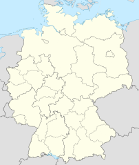
Deutsch: Positionskarte von Deutschland mit Grenzen der Regierungsbezirke und Landkreise
Quadratische Plattkarte, N-S-Streckung 150 %. Geographische Begrenzung der Karte:
English: Location map of Germany with waterbodies
Equirectangular projection, N/S stretching 150 %. Geographic limits of the map:
|
| Datum | |
| Quelle |
Eigenes Werk Diese W3C-unbestimmte Vektorgrafik wurde mit Adobe Illustrator erstellt. Diese SVG-Datei wurde mit Commonist hochgeladen. Diese Datei enthält Elemente, die von folgender Datei entnommen oder adaptiert wurden: Diese Datei enthält Elemente, die von folgender Datei entnommen oder adaptiert wurden: |
| Urheber |
TUBS |
| Andere Versionen |
_-_de_-_colored.svg) |
Lizenz
Ich, der Urheberrechtsinhaber dieses Werkes, veröffentliche es hiermit unter der folgenden Lizenz:
Diese Datei ist unter der Creative-Commons-Lizenz „Namensnennung – Weitergabe unter gleichen Bedingungen 3.0 nicht portiert“ lizenziert.
- Dieses Werk darf von dir
- verbreitet werden – vervielfältigt, verbreitet und öffentlich zugänglich gemacht werden
- neu zusammengestellt werden – abgewandelt und bearbeitet werden
- Zu den folgenden Bedingungen:
- Namensnennung – Du musst angemessene Urheber- und Rechteangaben machen, einen Link zur Lizenz beifügen und angeben, ob Änderungen vorgenommen wurden. Diese Angaben dürfen in jeder angemessenen Art und Weise gemacht werden, allerdings nicht so, dass der Eindruck entsteht, der Lizenzgeber unterstütze gerade dich oder deine Nutzung besonders.
- Weitergabe unter gleichen Bedingungen – Wenn du das Material wiedermischst, transformierst oder darauf aufbaust, musst du deine Beiträge unter der gleichen oder einer kompatiblen Lizenz wie das Original verbreiten.

|
Es ist erlaubt, die Datei unter den Bedingungen der GNU-Lizenz für freie Dokumentation, Version 1.2 oder einer späteren Version, veröffentlicht von der Free Software Foundation, zu kopieren, zu verbreiten und/oder zu modifizieren; es gibt keine unveränderlichen Abschnitte, keinen vorderen und keinen hinteren Umschlagtext.
Der vollständige Text der Lizenz ist im Kapitel GNU-Lizenz für freie Dokumentation verfügbar. |
Du darfst es unter einer der obigen Lizenzen deiner Wahl verwenden.

|
Wenn du die Datei außerhalb der Wikipedia oder Commons verwendest, begrüße ich es, wenn du als Quelle Wikimedia Commons angeben könntest. Wenn du die Datei in einem Buch, Zeitung, Blog, Webseite, etc. verwendest, füge bitte hier folgende Zeile ein:
|
_location_map.svg)
Dateiversionen
Klicke auf einen Zeitpunkt, um diese Version zu laden.
| Version vom | Vorschaubild | Maße | Benutzer | Kommentar | |
|---|---|---|---|---|---|
| aktuell | 14:40, 14. Mai 2022 | | 1.073 × 1.272 (2,21 MB) | TUBS | erlangen + höchstadt - double borders |
| 14:18, 14. Mai 2022 |  | 1.073 × 1.272 (4,18 MB) | TUBS | Reverted to version as of 09:22, 14 February 2020 (UTC): reverted. Did more harm than good (esp. concering islands in the Baltic and North See) and double/ghost borders. Will deal with the Franconian issue later. | |
| 10:49, 7. Dez. 2021 |  | 1.073 × 1.272 (4,15 MB) | TUBS | erlangen + höchstadt vereint | |
| 11:22, 14. Feb. 2020 |  | 1.073 × 1.272 (4,18 MB) | TUBS | pushed LK Kehlheim to the right Bezirk. ((This is not an update. Some districts have merged by now, e.g. Göttignen/Osterode. Some borders have changed as of February 2020. Don't have the time to redraw the map.) | |
| 15:01, 29. Okt. 2013 |  | 1.073 × 1.272 (3,17 MB) | TUBS | ||
| 14:52, 29. Okt. 2013 |  | 1.073 × 1.272 (1,61 MB) | TUBS | real loc map | |
| 20:44, 28. Okt. 2013 |  | 1.073 × 1.272 (5,82 MB) | TUBS | == {{int:filedesc}} == {{Information |Description={{de|Karte der politischen Gliederung Deutschlands in Länder, Regierungsbezirke, Landkreise und krsfr. Städte}} {{en|Map of administrative divisions of Germany. States, government districts, districts... |
Dateiverwendung
Die folgenden 2 Seiten verwenden diese Datei:
_location_map.svg)